Saturday, February 7, 2009

Pikes Peak COG Railway & Highway

There are several ways to get to the top of Pikes Peak. There is a road that you can drive to the top, “The Pikes Peak Highway”. There is even a race in the summer on the road. There are a couple different hiking trails to the summit starting on different sides of the mountain and there is “The Pikes Peak Cog Railway”.

We have driven up the highway several times with different visitors in tow, hiked up twice, and taken the cog railway up once.

The highway is mostly a gravel road after the visitor shop halfway up and does not have guard rails along it, so it can be a bit nerve racking for those not comfortable with heights and steep drops.

From Pikes Peak Cog Railway & Highway

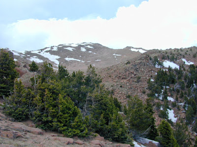
Usually snow covered at the top until late April or June

From Pikes Peak Cog Railway & Highway


From Pikes Peak Cog Railway & Highway

If you take the highway up:

Often the highway can be closed due to weather conditions in the spring and fall, and is usually closed in the winter. On the way back down Park Rangers will test the temperature of your brakes 1/2 way down to see if they are overheating and could fail. Brake failure on the Pikes Peak highway is not good thing!

From Pikes Peak Cog Railway & Highway

Our brakes are good at our check because we drove in a lower gear coming down. We get to continue and not have to wait 1/2 hour for them to cool down.

From Pikes Peak Cog Railway & Highway

Having been to the top of Pikes Peak all the other ways we decided that we should try the Cog railway once.

depot-with-crowd-loadingThe cog railway is a set of railroad cars imported from Switzerland that use a gear and cog system in the middle of the tracks to pull the trail to the top of steep grades. The depot at the lower end of the tracks is located in Manitou Springs just next to the Trailhead for the Barr camp trail to the top. The railway roughly parallels the Barr Camp trail halfway up the mountain then skirts around to the south side where it works its way to the summit. It requires an entire afternoon to go up and back. The day we road the train was overcast with cloud cover and we had to break though the cloud deck to get to the top.

From Pikes Peak Cog Railway & Highway

Once the train arrives at the top everyone gets off and goes into the gift shop for a while. The return trip is in about and hour.

From Pikes Peak Cog Railway & Highway

Also at the top is a monument with America the beautiful inscribed on it.

From Pikes Peak Cog Railway & Highway

The story goes that Katherine Lee Bates the writer of America the Beautiful was atop Pikes Peak and was so struck by the view out over the plains she was inspired to write the song “America the beautiful”.

From Pikes Peak Cog Railway & Highway

I guess I would call that view inspiring!

From Pikes Peak Cog Railway & Highway

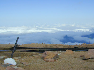
Can’t see the plains today for the cloud cover

From Pikes Peak Cog Railway & Highway


Back on the train on the way down a different view of the bottomless pit that we had looked at up close on an earlier hike.

From Pikes Peak Cog Railway & Highway

Farther down the track on the south side of the mountain

From Pikes Peak Cog Railway & Highway


From Pikes Peak Cog Railway & Highway

We stop and wait for the train coming up because there is only one track and this is the only switch area.

From Pikes Peak Cog Railway & Highway

The snow is still deep in areas early in May.

From Pikes Peak Cog Railway & Highway

As we move back into the tree line below 13,000 feet  the snow thins out.

From Pikes Peak Cog Railway & Highway


From Pikes Peak Cog Railway & Highway

While the cost of a ticket on the Cog railway (Cog railway WEB site here)  is a bit expensive it is a nice way to enjoy an afternoon.

Rampart Reservoir

rampart resRampart Reservoir is one of reservoirs that supplies Colorado Springs with drinking water. While it is open to the public and there is a recreation area where you can camp and enjoy the area, there are restrictions on what you can do. While you can boat, fish and picnic, you cannot swim or wade in the water. There are great hiking trails around the area and that is what we did when we went there in the early October one sunny Sunday afternoon.

From Rampart Res

The reservoir is large and spreads out over dozens of square miles. It’s at a very high elevation 10,000 ft in the front range mountains, with Pike Peak in the background it a spectacular sight on a beautiful day.

From Rampart Res

Even though it was a bit cool the sunshine at the high altitude has heated the rocks to a nice warm temperature and it was pleasant to sit on them and feel the heat radiated back.

From Rampart Res

Like most reservoirs the water level fluctuates widely with the seasons and that make for stark and interesting formations along the shoreline.

From Rampart Res

From Rampart Res

As we hiked along the shoreline trails, following little fingers of water that fill the once dry mountain valleys, different landscapes take shape.

From Rampart Res

Looks like someone painted here

From Rampart Res

Interesting rock formation often require climbing them for closer inspection

From Rampart Res

A picture on the top

From Rampart Res

Getting back down is not always as easy are going up.

From Rampart Res

We ultimately hiked about 1/3 of the way around the reservoir in half a day, but did not have time left in the to completely circle it, so we had to retrace our steps and return to our Jeep.

From Rampart Res

All in all a worthwhile day hike if you are in the Colorado Springs area someday.

Tuesday, February 3, 2009

St Mary’s Falls

St Mary’s Falls is one of the longer and more beautiful waterfalls in the Front Range area of Colorado. (Hiking directions here) Its not a terribly long hike 5-6 miles round trip to the top of falls and back, but it can be a difficult hike. Its steep in spots and requires some scrambling over loose rocks and terrain. It is worth the difficulties though.

Our hike was going to be with some friends of ours Dean and Danny. We have hiked with them frequently. (See out Pikes Peak Adventure). The trail starts in North Cheyenne Canyon and for the most part follows Cheyenne Canyon Creek that makes up the Falls up the mountainside. If you fallow it far enough you will end up in Deep Park and ultimately the top and Almagre mountain.

You can drive to the top of North Cheyenne canyon and park in the lot next to the old section of Gold Camp road or as we did you can park at the Helen Hunt falls lower down in the canyon and hike up past Helen Hunt to St Mary’s Falls. It is said that the creek contains over 33 separate falls over three feet high along its length. I didn’t count to make sure though.

Pictured here is an interesting part of Helen Hunt falls. I think they call it Dead mans falls because so many people go out on the rocks and slip and fall.

From St Marys

Part of the climb from Helen Hunt to Gold Camp road can get a bit steep and treacherous.

From St Marys

Once up to Gold Camp road ( you can see it in the distance across the valley)

From St Marys

You follow the road along to one of told cave-ins that blocked the road years ago.

From St Marys

From St Marys

From St Marys

From this point you have to climb up the side of the cave and off into the woods, following the water ever higher.

All along the way are beautiful little water falls that you can stop by and enjoy.

From St Marys

We stopped and refilled out drinking water by filtering water from the creek into our canteens. The water here is the coldest and best tasting water you are likely to find in the anywhere world.

From St Marys

Farther up you can see the falls. The water cascades down a rock sheet for a couple of hundred yards.

From St Marys

The trail up the side of the falls in steep and rugged.

From St Marys

The top of the Falls where the rock sheet flattens out, and the Falls start.

From St Marys

Lunch and pictures.

From St Marys

We decided to continue up the mountain to get to the top for a better view.

From St Marys

Seems like the extra work was worth it!

From St Marys

Wandering around the top we found and old miners camp.

From St Marys

Looking inside you can see and old stove and plastic hanging against the walls. It looks like someone might have stayed here recently.

From St Marys

Sunday, February 1, 2009

Almagre Mountain & Stratton Reservoir

Almagre Mountain at 12367 feet is the second highest peak on the horizon from Colorado Springs. It lies just south east of Pikes peak a few miles. There is a number of trails to reach it, and if you have a death wish you can even drive a 4 wheel vehicle almost to the summit. The road is really narrow, bad and may be impassable in places. We chose to take our jeep up the Gold camp trail to a beautiful meadow about 4 miles below the summit called Deer park and camp there.
From Stratton Resovour
Just below the summit of Almagre in the valley formed by Almagre and Mount Baldy is an old reservoir that use to supply the city of Colorado Springs with drinking water.
From Stratton Resovour
The reservoir is no longer used because they partially drained it when the dam that held the water in place became old and unstable. After decommissioning the reservoir people can now hike to it or swim in it (very very cold in May when we were there).
Just off Gold camp road a few miles down an old forest service road we set up camp along a creek in what is know as Deer Park.
From Stratton Resovour
Its about a 4 mile hike to the summit and the reservoir. Part of the way you could drive, but we chose to hike up the side of the mountain on a poorly marked trail instead of the old narrow road. Here and there in the hillside you could find old jeep trails. Below you can see Deer park it is the clearing in the valley
From Stratton Resovour
Nearly to the top just off the old road you can see Colorado Springs to the east in the distance.
From Stratton Resovour
Here you can see the old access road leading to the reservoir. One wrong move and its over the edge you go!
From Stratton Resovour
Past the old gate into the valley from Almagre and Baldy you can see what’s left of the old reservoir. Down in front is the old dam holding back the remaining water. Looks like its a bit cold to go swimming.
From Stratton Resovour
Inside the old reservoir
From Stratton Resovour
Taking a break on a comfortable rock
From Stratton Resovour
Almagre’s summit
From Stratton Resovour
Beautiful views of the Front Range spread out before us on the way back down
From Stratton Resovour
Just down the road looking back you get a good view of the old dam holding the reservoir. You can see how all the melting snow use to feed the water levels. The valley leading away from the dam has a small creek, that now flows down the mountain.
From Stratton Resovour
Back at camp a few hours later celebrating another great hike, around the campfire.
From Stratton Resovour
The summit team poses in front of the camera positioned on a tripod, but what’s in those coffee cups?
From Stratton Resovour