Saturday, March 14, 2009

Red Rock Canyon Trail

Over the years when ever we ended up in Las Vegas often on business it became a tradition to find a new hike. Sometimes if there were others involved from the business they asked if they could come along on the hikes.

One the occasion of a hike we planned along the ridge across the top of several peaks in the Spring Mountain Range near Red Rock canyon we gathered a crowed. While the crowed didn’t have much experience in the mountains this was going to be a fairly easy trail. Part of the way the trail follows an old 4 wheel drive track so even through it was long 6 or 7 miles round trip it wasn’t to steep and it was wide. It was a good trail for first timers.

So early on a Sunday morning Rich an old hiking partner ( you have seen Rich in other hikes) Margaret and I stopped at a grocery store picked up lunch (and of course a bottle of wine for the summit), then we picked up our crowed and headed for the trailhead.

It was a cool day but the sun was shining nicely as we headed off up the old Jeep trail towards the summit. The old jeep trail was easy walking and wound its way around to the back side of the summit for a couple of miles before it started a switchback assent.

The assent wound its way through a scrub pine dessert area working its way steadily toward the top of one of the peaks in the Mt Wilson area of the Spring Mountains. The pines made for great leaning posts for the folks that needed frequent rests.

Rich takes a break sitting on a rock with a beautiful scenic overlook of the old Jeep trail we followed up the canyon.

A summit photo of our hiking party (minus the photographer).

Everyone enjoyed lunch and a glass of wine on the summit with Las Vegas stretching out below us to the east.

Sitting on the summit we could see that we had made a 3 or 4 mile loop around the summit on the old jeep trail and we could now see that if we bushwhacked straight down the north side of the mountain we would cut a couple of miles off the return trip. Sounds like a good idea! So with Rich and I leading the way we set off.

Here you see a couple of newbie hikers on their first bushwhacking experience picking their way down a mountain slope without the benefit of a trail.

Soon we found our way back to the old jeep trail saving a few miles of trekking and an hour or so of time.

Wednesday, March 11, 2009

Ice Box Canyon

icebox canyon Las Vegas is an interesting city to explore even if you don’t gamble or hang out in the casinos. Some of the best hiking in the southwest can be found in the area around Las Vegas. This make it possible to do cool hikes during the day and then hang out on the strip at night

Just to the North and West of Las Vegas is a national conservation area called Red Rock canyon. Its part of a BLM area and has some great hiking trails and rock climbing areas. We have explored many of the hikes along this area.

One of the many trails along the mountains to the west is Ice Box Canyon. On this trip we had a friend Rich along and packed a lunch for a day trip into the Canyon. The canyons name “Icebox” comes from the unique features of water and canyon walls that create a much cooler environment in the canyon than the surrounding area. We parked along the Scenic Red Rock Drive in the BLM park and had lunch as a bench on the first part of the trail leading up to the Canyon. The hike is a pretty easy hike so lunch has a bottle of wine included.

After lunch we set off for the canyon in the distance between two mountain peaks.

Here you can see the entrance to the canyon. It looks almost like a crack in the face of a cliff.

Getting closer to the entrance you can feel the cool air coming out of the canyon.

At the far end of the canyon is small water fall in the wet season with a pool of water at the base,

Water trickles down from higher up in the Spring mountain chain and eventually makes it way to the valley floor

Its a neat place to spend some time. Margaret and Rich pose for a picture.

Then all of the hikers.

On the way back out of the Canyon while you are still higher up you are treated to a great view of the strange Gray and Red mountain of rocks that the BLM area is names for “Red Rock Canyon”

Back to the hot tub at the hotel in Vegas!

Friday, March 6, 2009

Camelback and Squaw Peak

If you have ever spent anytime in the Phoenix area you have almost certainly heard of Camelback and Squaw Peak. They are both mountain parks in the Phoenix metro area and are peaks with heavily used trails to the summit. On a nice day in either park it would not be unusual to see several hundred people making their way to the summit of either peak.

Both Camelback and Squaw Peak have special significance to Margaret and I. They were the very first real mountains that we ever climbed years ago. They were in a way responsible for our whole “You have to stand on the high place” problem. The very first time to the top of Squaw Peak it took us several hours just to get to the summit. We later learned that people run to the top and back in 45 minutes. After a few times we got to the point where we could summit in 45- 50 minutes, but run to the top no not quite.

After a while we have been to the top of each mountain so many times that we stopped keeping track or taking pictures. Almost every year when we were in Phoenix we would make several trips to the top of each peak. We have even gone up one in the morning and the other in the afternoon.

Each summit trail is less than 2 miles. So they are not very far as trails go, however they are both fairly steep and rugged trails. Each mountain also has more than 1 trail to the top and we have been up and down all the available trails many times each. Since it can be very crowded on these trails at peak times the amount of people can make for difficulties in hiking the trails.

Below is one of the more interesting sections of the Echo canyon trail to the top of Camelback. You can see the number of people working there way to the top of the steep rocky section aided by the pipes in the ground.

From Squaw Peak & Camelback

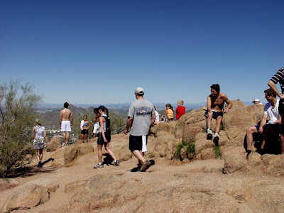
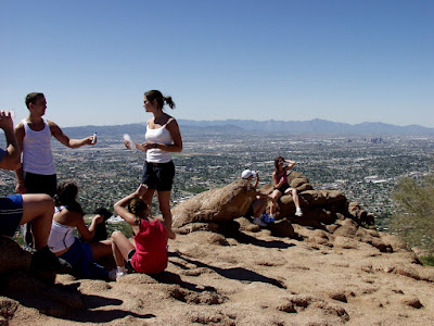
Here at the top of Camelback is a typical contingent of trail climbers early in the morning

From Squaw Peak & Camelback

We have seen people climb these rocky trails in sandals, bare foot, and in every manner of dress imaginable. Some people have no common sense at all.

We have gone to the top in the spring, and fall of the year, when its 70 degrees and when it 106 degrees. One particularly memorable trip to the top of Camelback occurred in September with the temps in the morning of around 90 degrees. We selected the Cholla canyon trail (the back way) to the top of Camelback which is a bit rougher and tougher of the two trails. We got a late start, but had plenty of water and were dressed for the sun so we weren't to worried. As we worked our way to the top the temps continued to climb. We stopped often to rest and cool down but the high temps were taking their toll.

From Squaw Peak & Camelback

We eventually made it to the top, but there is little shade on a mountain top on 106 degree afternoon. Margaret did manage to find a shelter from the sun on the shady side of a pile of rocks where she plopped down and started sucking on her water bottle.

From Squaw Peak & Camelback

Camelbacks sister peak just a couple of miles north, Squaw peak is now called Piestawa Peak. It sits in the middle of a Regional Park and is an imposing mass of sharp lava rocks with two trails running to the top.

From Squaw Peak & Camelback

There are many trails running all over the park, but the most commonly used one it the summit trail near the entrance to the park.

From Squaw Peak & Camelback

The summit of Squaw peak is a uplifted mass of broken rocks

From Squaw Peak & Camelback

Combine the fact that the trail to the summit is often steep and filled with broken rocks, with the hundreds of people that climb it every day and it seems like at least once a week someone breaks an ankle or a leg and has to get airlifted off the peak. (See the helicopter in the valley below)

From Squaw Peak & Camelback

We have many times seen rescue squads running to the top or helicopters hauling someone off the mountain.

From Squaw Peak & Camelback

Here is Margaret climbing the last 50 feet to the summit of Squaw Peak

From Squaw Peak & Camelback

From Squaw Peak & Camelback

Here are a few pictures from the summit over the years.

From Squaw Peak & Camelback

What a babe!

From Squaw Peak & Camelback

The both of us at the summit of Squaw Peak

From Squaw Peak & Camelback

There have been countless trips to the summit of these two peaks in our life. Here's to countless more!

Sunday, March 1, 2009

Angels Bridge

Angels bridge is a red rock arch in a canyon wall near the end of the Fay canyon trail south of Sedona.

From Angels Bridge

The trail head is easy to get to and the Fay canyon trail is wide, flat and sandy along its length.

From Angels Bridge

A little over half the way down the canyon a side trail leads off to the left and the Angels bridge. I suspect its called Angels bridge because only angels will go up there. In this zoomed in photo of the arch it doesn't look like it would be too tough to walk up the right hand side to get to the top. Unfortunately zoomed in pictures give little real perspective.

From Angels Bridge

The wide sandy trail disappears as you head towards the bridge.

From Angels Bridge

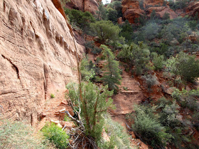
Looking at the nearby canyon walls you can see interesting rock formations.

From Angels Bridge

As you get closer to the bridge the trail gets steep and rocky. The faint of heart usually stop here and observe the bridge from a distance . We met a group that wasn’t properly attired for the thorny brush and rocks, and made the wise decision to turn back.

From Angels Bridge

Views above the trees of the canyon from part way up the canyon wall.

From Angels Bridge

When you get up the loose rock and under the bridge you can get a real perspective of the natural red rock arch. The arch spans roughly 40 yards and is 50 feet high. Impressive!

From Angels Bridge

The arch supports itself and is about 20 feet out from of the canyon wall. Trees and vegetation grow up between the wall and the arch where they can get light.

From Angels Bridge

Looking out underneath the arch at the far canyon wall.

From Angels Bridge

Here on the narrow ledge beneath the arch Margaret explains why she thinks we should try the scramble up the side and stand on top of the arch. :)

From Angels Bridge

Back against the wall of the canyon are hundreds of strange little holes in the wall.

From Angels Bridge
From Angels Bridge

Looking along the side of the bridge you can sort of see the trail up to the top. This will be fun!

From Angels Bridge

Here comes Margaret picking here way up through the broken rocks along the way to the top of the bridge.

From Angels Bridge

Looking back from halfway up you can see the bridge.

From Angels Bridge

Once on the top there is a narrow, slippery dirt strewn path you have to cross to get onto the bridge. Don’t look down, and don’t slip!

From Angels Bridge

Your first view of the top of the bridge.

From Angels Bridge

Here is Margaret picking here way across the narrow bridge to the other side choosing her steps carefully. Steep drops exist on either side.

From Angels Bridge

Near the other side of the bridge you have to slide around a large pile of rock in the middle to finally get across.

From Angels Bridge

At last the crossing is complete and Margaret looks up and poses for a picture while tightly holding onto the big rock.

From Angels Bridge

Lunch time with the angels and a picture of us both with the camera on its little traveling tripod.

From Angels Bridge

More interesting rock formations along the canyon wall on the way back down the canyon.

From Angels Bridge

Angels bridge is a great hiking trail and adventure whether you climb to the top or not. Enjoy life!