Saturday, April 3, 2010

Ford Canyon White Tank Mountains

We have hiked in the White Tank Mountain Regional Park many times before. It is close to the place we stay at when in Phoenix and it has some nice hiking trails. Previously we have hiked the Goat Camp Trail (7 Miles) and the Water Falls Canyon trail (1-2 miles).

If you look up Ford canyon trail on the map it connects to Goat Canyon Trail at the top of the White Tank Mountains. The round trip is roughly 13-14 miles. Today we are not going to go that far, we are just going to hike up to the abandon dam roughly 3.5 to 4 miles one way or 8 miles roundtrip.

image

We started our hike at about 8:30 in the morning at the trail head in parking spot # 9. Its a mile or 2 around the end of the mountain range to the beginning of the Ford Canyon trail where the hiking gets interesting.

P1011993

With the recent rains in Arizona the wild flowers are in bloom and the beginning of the trail is very colorful.

P1011909

All along the trail the Bluebells are in bloom.

image

About mile marker 2 the flat Horse, Biking, Hiking trail gives way to a more rugged trail restricted to hiking only.

image

I guess that the previous sign was not kidding about the rugged trail ahead!

image

As we move higher into the canyon there are signs of water and under some rocks we find some Desert Ferns.

image

Around mile marker 4 on the rocky trail pools of water can be seen collecting in low spots.

image

At about 4.5 miles is the old abandoned dam that used to collect water. Now it is all silted in behind the low dam and the water runs over the top during heavy rains

image

Panorama of the abandon Ford Canyon Dampano Ford Canyon Dam

Going up steep rocky faces is all ways easier than coming down and Margaret shows how it is done.

P1011979

The rock scampering queen takes a break in this shady spot by one of the stagnant pools.

image

We stopped for lunch on a bluff overlooking the desert floor before hiking out of the canyon on the walk back to the trailhead.

image

We hiked into the trailhead at a few minutes after 1:00PM roughly 4 hours round trip.

Friday, April 2, 2010

Sabino Canyon

image

Sabino Canyon in the foot hills of the Santa Catalina Mountains north of Tucson Arizona has been on our list of places to see and hike for years. We tried several years ago to hike there and were thwarted by the park being closed down due to Mountain Lion activity.

The valley is a part of the drainage system for the entire mountain chain. This creates a nearly year around flow of water in the desert which draws all sort of critters to drink, including lots of Mountain Lions.

Our hike this year started about 9:00 AM in the morning from the parking lot of the visitors center. Near the entrance to the park is a sign warning of the frequent sighting of Mountain Lions, and while it doesn't say it on the sign I know that a Mountain Lions favorite meal is “Irish Rump Roast”. This was on Margaret’s mind all day as we hiked!

P1011690

Years ago you could drive a car into Sabino canyon, but in the 1970 they closed it to public traffic and now the only way to get to the top of the canyon is walk the 3.8 miles one-way or take the park trams for $8 per person. Since the point to this trip was hiking we opted to walk and took the back trails into the foothills and soon came upon the Sabino canyon dam.

Panorama of the Sabino Canyon DamSabino Falls Pano

Just up stream from the dam as you move further up into the canyon is a seldom seen beautiful scene of desert landscape and clear, clean water flowing over the pebbled creek bed.

Panorama of the Sabino Creek above the DamSabino Creek Pano

After a couple of miles following the river trials we ran into the tram road the leads to the top of the canyon.

While the tram road didn’t have the solitude of a desert trail the beautiful stream enticed us to follow it further up the canyon. Following the tram road we crisscrosses the river several times as it winds it way up the canyon. With all the recent rain in Arizona this winter the river is overflowing the tram trail in several places and required wading through the water to proceed.

P1011768

Panorama of the Sabino Creek overflowing the Tramways

Margaret and bridge pano

As you walk up the tramway trail towards the top of the canyon you have to watch closely for trams! There is not enough room on the bridges for people and trams at the same time!

P1011760

Panorama of the Sabino Creek overflowing the Tramways

Sabino 1st Bridge pano

About 5 or 6 miles into the hike we came to a small waterfalls that seemed like a great place to take a break and observe the water while relaxing the sore feet.

P1011812

The clear, ice cold water refreshes your feet after a few miles in hot hiking boots.

image

So far Margaret has avoided being a Mountain Lion snack, but there are still several miles to the top.

P1011814

Finally at the top Margaret finds a small spot of shade behind the rock for a brief rest before turning around and heading back down.

P1011836

About halfway back down we found a nice shady spot to have lunch and cool our feet in the stream again.

Sabino lunch 2 pano

Panorama of a cool shady lunch spot

Sabino Lunch pano

The last mile of our 9 mile hike into Sabino Canyon is out on the desert floor far away from the cool stream and valley and seems to take forever.

P1011886

About 3:00PM we made it safely back to the parking lot and avoided being Mountain Lion fare, so the cats will have to go hungry for another day.

Saturday, April 11, 2009

The Big Lake

The Big Lake is really big. It is the largest fresh water lake in the world by area its over 1300 feet deep and 160 miles across. The lake is so big the water never warms up. In the summer the average temperature is 40 degrees. The Big Lake, Lake Superior is one awesome lake.

The area along the Northwest shore of the lake in Minnesota is called the North Shore. Its a great place to hike and bike or just explore. The rocky rugged shore line and countless rivers that empty into the Lake are spectacular places to spend time.

We have been there many times. You have already seen some posts from along the North Shore including Eagle Mountain and Carlton Peak from us. We have hiked, biked, dived, and climbed all along the Great Lake over the years. This post is a recap of several trips and and focuses on the just the Great Lake itself.

It seems like you can spend hours just exploring the rocky coast almost anywhere along the North Shore. Some favorite places are Split Rock Light House, Gooseberry Falls, Grand Marais, Lutsen, Cascade River and many more State Parks all along the shore.

Gooseberry Falls Area

At Gooseberry Falls State Park you can see the falls, camp, and explore a section of the lake with large boulders, and beautiful rocky inlets. After scrambling down the steep cliff to the lake you can walk along the shore exploring the nooks and crannies with little pools of water.

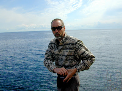
There is always a sunny spot to enjoy the views and pose for a picture.

The water in the lake is an amazingly clear and an azure blue green color that makes is very inviting. However it is cold. Do not fall in!

Sometimes it takes both hands to get down to the water.

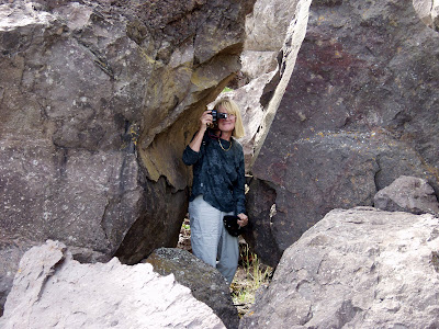
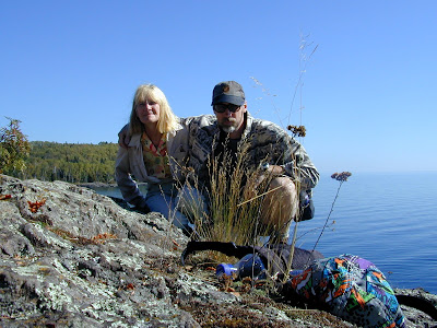
You never know what surprising little creatures you will find lurking in the cracks of the large boulders.

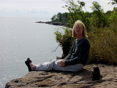
Or sunning itself on the cliffs overlooking the lake.

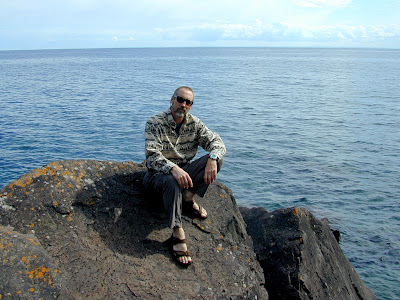
Now here is and interesting pair!

Tofte Area

There are of course many places to stay along the big lake, but one of the more popular and almost legendary places is the Blue Fin Inn in Tofte. Built right on the lakeshore on Blue Fin Bay it is a complex of privately owned condos that are rented out as a hotel. We have stayed here several times and have enjoyed each and every time.

It has a rock beach where they have camp fires every night with marshmallow roasts, as well as bars restaurants, pools and hot tubs.

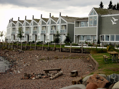
You can walk the boardwalk between buildings along the bay to different parts of the complex where you will find a variety of things to see and do.

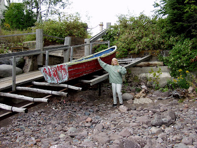
From old fishing museums that show how they used to catch the Blue Fin Fish in the bay

To picnic shelters and walkways through the little village of Tofte.

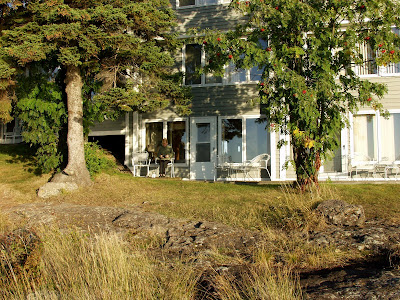
Early one morning just before the sun rises in the east over the lake Margaret sat out on the lakeshore behind the Blue Fin Inn wrapped in a blanket and took this set of beautiful sunrise photos. (while I slept peacefully inside in the nice warm room)

Later I managed to get up and make my way outside to get this snapshot of the great sunrise photographer having her tea at the patio outside our room.

Split Rock

One of the many attractions on the North Shore is the Split Rock Lighthouse. No longer in use as a warning beacon to protect ships on the lake from the treacherous rocks on the shoreline it has become a museum in a State Park. (Its worth the few bucks to take the tour)

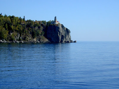
Notice how this picture of the lighthouse looks much better with the additional content in the photo.

Just down the shoreline from the lighthouse is a beautiful rocky beach with the remains of an old fishing camp where a few brave souls dare take a plunge in the freezing waters of Lake Superior.

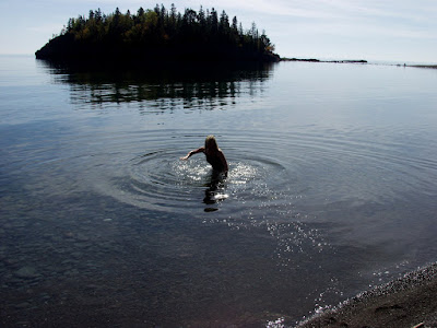
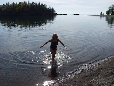
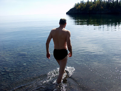
After a brisk swim we dressed and sat on the beach and had a picnic. Shortly after a pair of young ladies came down to the beach dressed in their swimming suits. They placed all their belongs neatly on the rocky shore and prepared to go into the inviting looking water for an enjoyable swim in warm bright sunshine. (This is going to be good!) Well you have never heard so much screaming! The swim was short and sweet. One girl managed to get in the water for a short dip the other couldn't quit do it ,and retreated to the safety of the beach.
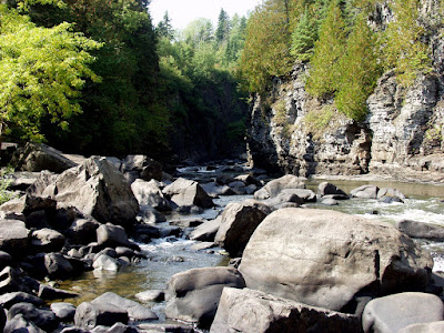
Border Country

Just to the north of Grand Marias is the Pigeon River and Grand Portage State Park. The river acts as the border between Canada and Minnesota. The tallest waterfalls in Minnesota is located on the river just a mile or two from the highway in a scenic park.

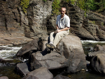
Standing on a boulder in the middle of the river the right hand side is Canada the left hand side is Minnesota. Looks like Homeland Security missed securing this part of the border.

Here is a couple of potential terrorist sneaking across the border.

The Pigeon River Falls

The “Big Lake” is a not to be missed area to be visited in anyone’s personal tour of our beautiful planet.